 |
|
|
COMMITTEE WORKING GROUP | DR. ERNEST MARTIN, CHAIR
Urban Infill & Greenway Minutes 2016
|
- January 21, 2016
- Feb. 24, 2016
- April 22, 2016
- May 19, 2016
- June 22, 2016
I. Consideration of “Naheem Kahn” Project, 1175 NW South River Drive:
The Miami River Commission’s November 2, 2015 public meeting minutes were distributed stating, “The following documents were distributed prior to the meeting, presented and reviewed during the public meeting, regarding 1175 NW South River Drive:
• Board of County Commissioner’s Economic Prosperity Committee’s Agenda Item 2(B), a $1.5 million “Economic Development Fund” grant to fund a public Riverwalk and new seawall at the “Naeem Khan Project”.
• City of Miami’s adopted zoning code section 3.11 and Appendix B
• City of Miami’s adopted zoning code, “Article 4, Table 3, Building Function: Uses”
• Miami River Commission’s Greenways subcommittee’s 10/21/15 public meeting minutes
1st Draft Plans for Naeem Khan’s Proposed Development
Director Bibeau stated the distributed County Agenda item was approved at County subcommittee and will be considered by the full Board of County Commissioners on 11/3/15.
Mr Naheem Khan, Ms Rosario Kennedy and Mr Alfonso Jurardo, Architectonica, distributed and presented the 2nd draft plans and narrative. The 2nd draft plans now feature a vessel along the river, and the public Riverwalk connects to the west with the existing public Riverwalk beneath and adjacent to 12 Ave Bridge, and to the east along the sideyard connecting with the existing on road Miami River Greenway on North River Drive at the south east corner of the site.
Mark Bailey, Miami River Marine Group, noted 1175 NW South River Drive, leased by the Board of County Commissioners to Naheem Kahn for his proposed project, is zoned the most restrictive “D3” and the currently designated Land Use is “Port of Miami River”. Therefore, Mr. Bailey questioned if the proposed project is consistent with the vacant site’s existing land use and zoning, or would it require a land use & zoning amendment, “warrant” or “exception”? Mr Kahn and Ms Kennedy stated the project will use a vessel to import and export containers carrying fabric, beads, etc, in addition to recreational yacht access, therefore is consistent with the existing land use and zoning. Manny Prieguez noted he has shipped containers of seafood from his Miami River Lobster and Stone Crab site on the Miami River. Bruno Barreiro noted this County owned site has been vacant for years, and was previously a County Carpentry shop. The MRC unanimously recommended the Board of County Commissioners approve the grant for the site’s public Riverwalk and new needed seawall, and asked for the specifics of the development proposal to be considered by the MRC’s Urban Infill and Greenways subcommittees in November, followed by the full MRC on December 7.”
Ms Rosario Kennedy, Mr Alfonso Jurardo, Architectonica, and Ms Lucia Dougherty, Greenberg Traurig, distributed and presented the revised draft plans. The new plans increase the square footage by widening the west wall by 15’ on the site. Ms. Kennedy recommending relocating the City of Miami Fire Department’s storage of unused equipment adjacent to the site on South River Drive beneath the 12 Ave Bridge, which the City rents from FDOT. The Subcommittee Chairmen agreed.
MRC Director Bibeau distributed the City of Miami’s adopted zoning code, “Article 4, Table 3, Building Function: Uses”. Ms Dougherty noted the renditions still include a recreational yacht and an international shipping vessel transporting containers containing fabric, garments, and beads. Ms. Dougherty stated the plans will maintain the site’s current D3 zoning, Port of Miami River Land Use. Ms Dougherty stated it will be classified on the table under “Industrial” as either “Manufacturing and Processing” which would require a “Warrant” but requires less parking therefore the plans have sufficient parking spaces, or be classified as a “Marine Related Industrial Establishment” which would be “Allowed by Right”, but requires more parking spaces than the plans provide, therefore a reduction of required parking spaces would be required.
Mr Mark Bailey, Miami River Marine Group, asked if the development team had met with the U.S. Coast Guard regarding Homeland Security and NTSA requirements for this new proposed international shipping location, and DERM regarding obtaining the required marine operating permit, and the team replied not yet.
Ms Dougherty stated the developer is willing to design, permit, fund and construct the public Riverwalk connector on the west end to extend the additional estimated 35 feet on FDOT public ROW in order to connect with the existing public Riverwalk and sideyard connector at the 12 Ave Bridge. The site’s new public Riverwalk will feature a new seawall, maybe maintenance dredging along the shoreline, and a 6-foot wide dock. Chairman Aguirre noted the renditions for the dock need large bollards added, and the dock should be made of concrete to accommodate the depicted large shipping vessel.
MRC Urban Infill Subcommittee Chairman Murley and Greenways Subcommittee Martin suggested the MRC find the proposed development consistent with the Miami River Greenway Action Plan and the Miami River Corridor Urban Infill Plan subject to the following conditions:
1) Securing all vessel requirements established by U.S. Coast Guard, DERM, etc
2) Securing FDOT permission to construct the public Riverwalk connector to the west on FDOT ROW at the 12 Ave Bridge and removing the storage lot beneath the Bridge
II) Consideration of City of Miami’s Request for Proposals for a Restaurant and Restoration of the Historic Flagler Workers House in Fort Dallas Park (former Bijan’s Seafood) 60-64 SE 4 ST The item was deferred to the February meeting.
III) New Business
Chairman Martin and Chairman Murley re-stated the MRC’s support to extend the Flagler Street Improvements a few additional blocks to its dead end into North River Drive where Flagler on the River recently completed and Sushi Samba is under construction.
The meeting adjourned.
|
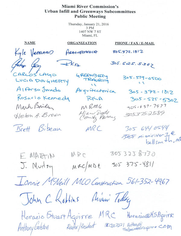
January 21, 2016 | THIS IS A PUBLIC DOCUMENT
The Miami River Commission’s (MRC) Urban Infill and Greenways Subcommittees conducted a joint public meeting on January 21, 2016, 3:00 PM, 1407 NW 7 Street. The attendance sign in sheet is enclosed. MRC Urban Infill Subcommittee Chairman Jim Murley and MRC Greenways Subcommittee Ernie Martin ran the meeting.
|
Miami River Commission’s
Urban Infill & Greenways Subcommittee’s Combined Minutes
I) Consideration of City of Miami’s Request for Letters of Interest for a Restaurant and Restoration of the Historic Flagler Workers House in Fort Dallas Park (former Bijan’s Seafood) 60-64 SE 4 ST
Dan Rotenberg, Director of City of Miami’s Property and Asset Management, presented the City of Miami’s advertised Request for Letters of Interest (RFLI) for a Restaurant and Restoration of the Historic Flagler Workers House in Fort Dallas Park (former Bijan’s Seafood) 60-64 SE 4 ST. Director Rotenberg stated bids are due April 18 for a short team lease on the site which would not require referendum.
MRC Director Bibeau thanked Director Rotenberg, Parks Director Kirwin and Downtown NET Director Plasencia for partnering on a 2 day clean up at FT Dallas Park on Feb. 24-25. Director Bibeau asked about if the site which has an excellent and valuable dock needs a State owned submerged land lease and Director Rotenberg stated it did not need one. Director Bibeau stated the area outside the current temporary chain link fence, featuring the public Riverwalk, side-yard connector and dock should be maintained at least at its current widths, and any new potential restaurant space should occur behind the current temporary fences, and Director Rotenberg agreed.
David Brown, Urban Tours, noted the importance of an educational component at the historic Fort Dallas Park featuring the designated historic Flagler’s Workers House, and attendees agreed.
MRC Greenway subcommittee Chairman Martin and MRC Urban Infill Chairman Murley found the advertised RFLI for 60-64 SE 4 ST to be consistent with the Miami River Corridor Urban Infill Plan and the Miami River Greenway Action Plan subject to a condition that any future redevelopment be consistent with City of Miami’s Zoning Code Section 3.11 and Appendix B, regarding the waterfront building setback, public Riverwalk requirements, etc.
MRC Greenways subcommittee Chairman Martin, Urban Infill Subcommittee Chairman Murley and Director Rotenberg agreed to review submitted bids during the May subcommittee meeting followed by the full MRC’s June meeting.
II) Consideration of City of Miami’s Request for Letters of Interest at 1 SW South River Drive
Dan Rotenberg, Director of City of Miami’s Property and Asset Management, stated the City of Miami’s draft Request for Letters of Interest (RFLI) for .17 acres of vacant land featuring 70 linear feet of riverfront, at 1 SW South River Drive, zoned T6-12, is currently being reviewed by the Law Department. Director Rotenberg stated this site’s 10 year lease plus 2 options for 5 year extensions would require referendum.
MRC Director Bibeau stated the City provided a draft RFLI for this site which was created in 2007 but never advertised. About a year ago the MRC recommended approval of the adjacent property (5 SW South River Drive) owner Arturo Ortega’s offer to fund improvements and maintenance of the City owned 1 SW South River Drive to make it a public park, including a new needed seawall, public Riverwalk, etc in return for waiving his sideyard building setback at 5 SW South River Drive.
III) Consideration of Zoning and Land Use Amendment Applications at 2501-2507 NW 16 ST RD from T5-L to T6-8-L and from Medium Density Restricted Commercial to Restricted Commercial
MRC Greenways subcommittee Chairman Ernie Martin stated he serves on the City of Miami’s Planning, Zoning and Appels Board (PZAB) and since this is a publicly noticed public meeting he is allowed to stay but will recuse himself from voting at MRC so that he may vote when the item is considered by the PZAB.
Mr Simon Ferro, Gunster Yoakley, Mr Jorge Azze, Azze Architecture and Mr Karl Peterson, KBP Consulting, presented the item. Currently the site features 249 rental residential units. The current zoning allows 65 units per acre for a total of 350 residential units with a maximum of 6 stories. The proposed zoning increase would allow 780 residential units, but they would provide a covenant limiting the maximum to 650 residential units, with a maximum of 8 stories. The City of Miami does not require plans to consider a land use and zoning amendment, and Mr. Ferro will not be submitting plans despite the MRC’s checklist of materials to present an item requiring plans as all previous zoning amendment applicants have provided the MRC. Mr Ferro stated after the zoning and land use amendments are voted on the City Commission, plans will be presented at a future MRC subcommittee and full MRC meeting. Mr Ferro stated he is not sure whether or not the project will be consistent with Miami 21’s requirements for a public Riverwalk, waterfront building setbacks, etc., as stated in Section 3.11 and Appendix B. MRC Greenways subcommittee Chairman Martin stated he prefers the standard operating procedure of receiving plans prior to MRC Subcommittee, MRC, PZAB and City Commission consideration of land use and zoning amendments which are provided the majority of the time. Mr. Ferro stated the zoning across the street from the subject site is zoned T6-8-L. Mr Ferro stated the applications are scheduled to be voted on by the PZAB in April and the City Commission in May or June.
MRC Director Bibeau noted the proximity of the 27 Ave Bridge and the traffic backup which occurs when it opens. MRC Chairman Aguirre noted the City’s Comp Plan requirement for all new riverfront developments to execute a “Working River” disclosure / covenant. The traffic consultant Karl Peterson stated the street currently has a “C” rating which would remain a “C” after the proposed completion of 650 residential units, and will meet the code’s parking requirements.
MRC Urban Infill Chairman Jim Murley suggested the MRC find the proposal consistent with the Miami River Corridor Urban Infill Plan and the Miami River Greenway Action Plan subject to the following conditions:
1) Full compliance with public Riverwalk, waterfront building setbacks, etc required in City of Miami’s Zoning Code Section 3.11 and Appendix B.
2) Connections to the existing public Riverwalk sections immediately east at “River Run South” and immediately west at “Miami Riverfront Residences”
3) Study Transportation on NW 16 ST RD
4) Provide new seawall if needed, and consider sea level rise in determining the best elevation
5) Provide working river covenant as required by City Comp. Plan
MRC Chairman Aguirre stated this item will be placed on the MRC’s March 7 public meeting agenda, noon, 1407 NW 7 ST.
IV) New Business
Chairman Murley stated he had read an article which reported River Landing’s number of residential units had increased, and the Riverwalk design had changed since the MRC recommended approval of the project. The project developer Andrew Hellinger subsequently emailed the MRC that the plans are currently the same as when presented to the MRC, with the same number of residential units (444) and the same public Riverwalk as originally presented and supported by the MRC.
Chairman Murley had directed MRC Director Bibeau to inquire about a proposed project called “River Tower” located at 230 SW 3 ST, adjacent to the City of Miami’s Riverside Center, which requires 6 waivers. The MRC received the following email:
“Brett,
Good morning.
SW 2 Avenue: At the ground level, our building is set back 20 feet at the narrowest point (24 feet at the northeast corner), with two small architectural features setback 18 feet. Again, the zoning setback is 10 feet at the ground level. From the property line to the street curb is approximately 10 feet. In other words, there is approximately 30 feet from building to sidewalk edge.
SW 3 Street: At the ground level, our building is set back 20 feet, with two small architectural features setback 18 feet. Again, the zoning setback is 10 feet at the ground level. From the property line to the street curb is approximately 10 feet. In other words, there is approximately 30 feet from building to sidewalk edge.
Thank you,
Ethan B. Wasserman
Greenberg Traurig, P.A. | 333 S.E. 2nd Avenue | Miami, FL 33131
Tel 305.579.0784
wassermane@gtlaw.com | www.gtlaw.com”
The next MRC Urban Infill and Greenways subcommittee’s public meeting will be March 17, 2 PM, and the agenda features presentations regarding the revised “Edge” development at 55 South Miami Ave RD and the new development proposal for the former “Epic Phase II” site.
The meeting adjourned.
|
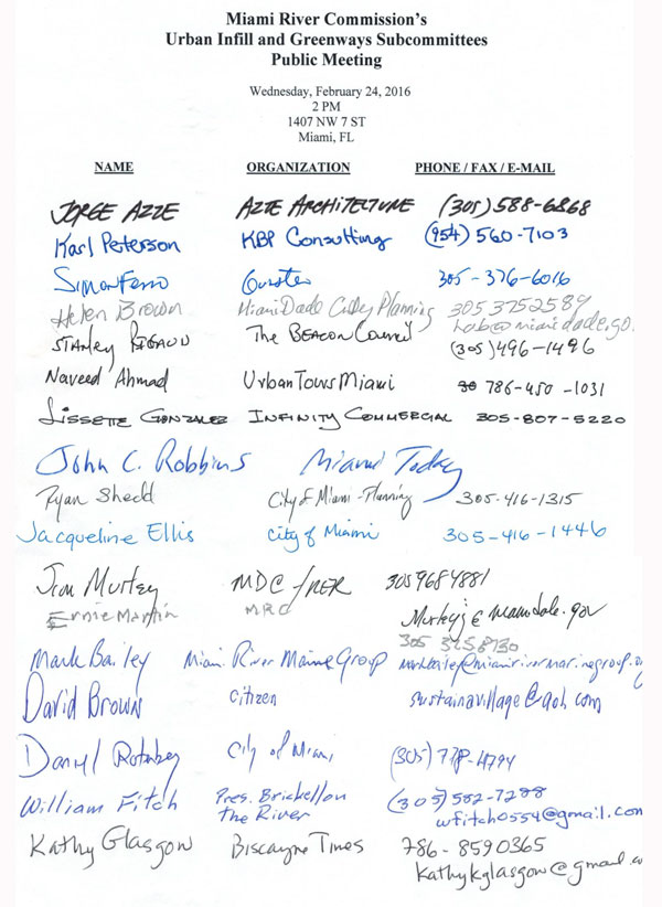
February 24, 2016 | THIS IS A PUBLIC DOCUMENT
The Miami River Commission’s (MRC) Urban Infill and Greenways Subcommittees conducted a joint public meeting on February 24, 2016, 2:00 PM, 1407 NW 7 Street. The attendance sign in sheet is enclosed. MRC Urban Infill Subcommittee Chairman Jim Murley and MRC Greenways Subcommittee Ernie Martin ran the meeting.
|
Miami River Commission’s
Urban Infill & Greenways Subcommittee’s Combined Minutes
I. Consideration of Development Plans for 55 South Miami Ave Road,
“The Edge”
Ben Fernandez, Berkow, Radell & Fernandez, Camilo Tamayo, Kobi Karp Architecture, Christopher Cawley Landscape Architecture, and Ignacio Permuy, Owner’s Representative distributed and presented revised plans for the “Edge” located at 55 South Miami Ave Road (former Big Fish restaurant site).
The following documents were provided to the applicants:
The City Charter, Subpart A, Section 3, Powers states:
"(mm) Building and zoning:
(ii) In order to preserve the city's natural scenic beauty, to guarantee open spaces, and to protect the waterfront, anything in this Charter or the ordinances of the city to the contrary notwithstanding, neither the city nor any of its agencies shall issue building permits for any surface parking or enclosed structures located on Biscayne Bay or the Miami River from its mouth to the N.W. 5th Street Bridge,
(A) which are not set back at least 50 feet from the seawall (where the depth of the lot is less than 200 feet, the setback shall be at least 25 percent of the lot depth),
(iii) The above setback and side-yard requirements may be modified by the city commission after design and site-plan review and public hearing only if the city commission determines that the modifications requested provide public benefits such as direct public access, public walkways, plaza dedications, covered parking up to the floodplain level, or comparable benefits which promote a better urban environment and public advantages, or which preserve natural features. Wherever setback, side-yard, or site-plan review requirements of zoning ordinances are greater than the foregoing requirements, such greater requirements shall govern.
(iv) These requirements shall not apply to docks and appurtenant structures, single-family residences and appurtenant structures, and waterfront industrial uses along the Miami River and at the Port of Miami. Nothing herein contained shall in any manner affect or apply to: the City of Miami/University of Miami James L. Knight International Center and hotel facility, including all improvements thereon, or to lands and projects which the city commission has approved prior to September 18, 1979”
Miami 21 (Zoning Code), states:
“3.11 WATERFRONT STANDARDS
In addition to the Miami City Charter requirements, the following Setback, walkways and waterfront standards shall apply to all waterfront properties within the City of Miami, except as modifications to these standards for all waterfront properties may be approved by the City Commission pursuant to the procedures established in the City Charter.
All Miami riverfront properties shall include water-related uses across all Transect Zones except T3.
a. Waterfront Setbacks
1. Waterfront Setbacks shall be a minimum of fifty (50) feet measured from the mean high water line provided along any waterfront, except where the depth of the Lot is less than two hundred (200) feet the Setback shall be a minimum of twenty-five percent (25%) of the Lot depth; and except for T3, T4-R, D1, D2 and D3 Transect Zones where a minimum Setback of twenty (20) feet shall be provided, except where the depth of the Lot is less than eighty (80) feet the Setback shall be a minimum of twenty-five percent (25%) of the Lot depth. These requirements shall not apply to Marine Related Industrial Establishments along the Miami River. Within D1, D2 and D3 Transect Zones facilities may span across man-made slips with a Structure to conduct marine-related commercial and industrial activities.
b. Waterfront Walkways Design Standards:
1. Waterfront walkways shall be designed and constructed within the waterfront Setbacks in accordance with these Waterfront Walkway Design Standards and should remain open to public access during all times, but at a minimum, shall remain open to the public between 6am through 10pm. Waterfront walkways are not required within Transect Zones T3, T4-R, D1, D2 and D3 unless the site is a new Commercial retail, Office or restaurant Use.
2. Waterfront walkways shall feel public, meet all Americans with Disabilities Act (A.D.A.) requirements throughout the entire length of the waterfront walkway and provide unobstructed visual access to the water.
3. Waterfront walkways shall connect to abutting public walkways, neighboring walkways, and Open Space at a consistent A.D.A. compliant width and grade to allow clear pedestrian circulation along the water’s edge.
4. The waterfront walkway surface shall remain at a constant elevation and be accessible to handicapped persons throughout the entire length of the waterfront walkway. Walkways should have a slight grade away from the bulkhead edge for stormwater retention within the transition zone.
5. The total width of a waterfront walkway shall be a minimum of twenty-five (25) feet and built to the standards and guidelines outlined in Waterfront Design Guidelines, on Appendix B.”
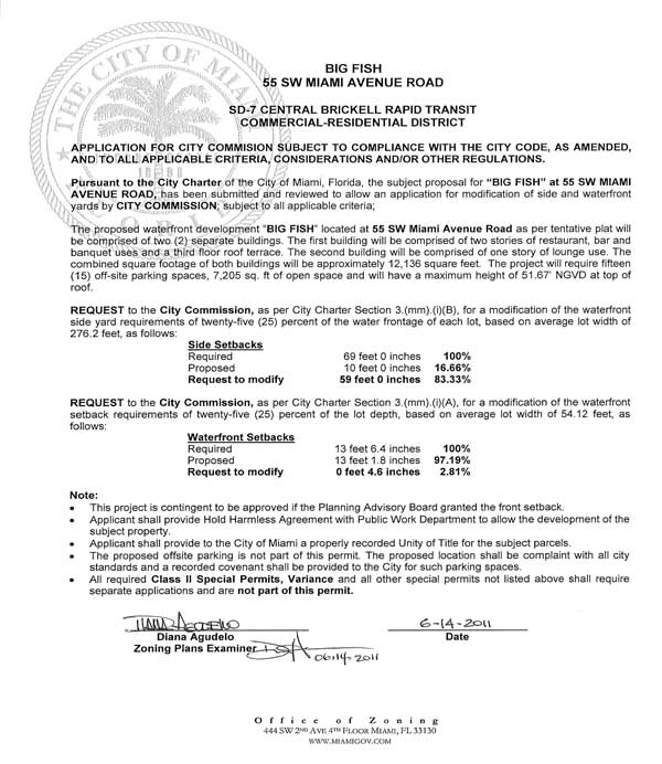
MRC July 11, 2011 public meeting minutes:
“MRC Chairman Aguirre welcomed Mr. Ben Fernandez, Bercow, Radell & Fernandez, and project architect D.B. Lewis, DB Lewis Architecture & Design, whom presented a revised proposal for a two-story restaurant (3rd Floor Terrace) and VIP lounge on the site of the former “Big Fish” restaurant, which they demolished, at 55 SW Miami Avenue Road, located west of the South Miami Avenue Bridge on the south bank of the Miami River.
Mr. Fernandez noted previous plans for the property included a boutique hotel and restaurant, yet when the hotel concept became economically unfeasible, the project was downsized to a two-story restaurant with a rooftop terrace and a VIP lounge. Mr. Fernandez noted the proposed project requires a Class II Special Permit from the City of Miami and was filed under the SD-7 building district regulations and former Zoning Code 11,000.
Mr. Fernandez noted the developer is requesting a front yard setback variance to allow 0 feet (where 10 feet is required). Mr. Fernandez explained the original Big Fish structure, which was demolished by the developer, was a non-conforming structure with a front yard setback variance as well. Mr. Fernandez stated he believed this would make the project more pedestrian friendly and would maximize the amount of total building footprint.”
Mr. Fernandez stated the lot is only 52 feet wide (River to sidewalk), which he noted imposes a tremendous design constraint. Therefore, Mr. Fernandez noted the building has been pushed up to the front property line and a courtyard/amenity plaza has been created at the center of the project for public use.
Mr. Fernandez stated the developer is requesting a variance of the waterfront setback requirement. Mr. Fernandez explained that according to the recent City of Miami “Zoning Write-up/Interpretation Letter” for Big Fish, the required waterfront setback is 13 feet, 6.4 inches, yet a waiver is being requested to bring this down by 4.6 inches-making the total proposed waterfront setback to 13 feet, 1.8 inches-of which he added the developer is very close to complying. Mr. Lewis explained the City Charter typically requires a 50-foot waterfront building setback-unless the depth of the lot is less than 200 feet. If a property is less than 200 feet, the setback shall be at least 25 percent of the total lot depth (from sidewalk to shoreline, in this case 13 feet 6.4 inches).
Mr. Lewis explained 5 feet will be provided on the east side yard (South Miami Avenue Bridge side) and 8 feet will be provided on the west side yard (i.e. three feet of landscaping and five feet of public walkway)-for a total sideyard setback of 13 feet (versus the required side yard setback of 69 feet, according to the City of Miami “Zoning Write-up/Interpretation Letter” for Big Fish – waiver number 3). Mr. Lewis noted a celebratory 50’ wide publicly accessible entrance to the restaurant and public riverwalk are being provided at the center of the property, as well as a small water feature and a circular staircase. Mr. Lewis stated within this 50’ entrance, a minimum 12’ will be unobstructed and publicly accessible to access the public riverwalk, even if not eating at the restaurant. Mr Lewis noted the design/architecture for the project is based on a Mediterranean, nautical theme.
Mr. Bibeau explained there are at least 3 different cross sections/dimensions to the 13-foot building setback and public riverwalk area depicted in the plans. Mr. Bibeau noted the version found on page A2.01A is the most favorable, as expressed by UIWG Chair Murley, as it features a 9-foot, 2 inch unobstructed riverwalk circulation zone and a 4-foot safety zone with lighting and landscaping. Mr. Bibeau noted it is permitted by City Code to remove 1 foot out of the safety zone (bringing it down to 3 feet) and transferring it to the circulation zone, increasing it from 9 to 10 feet. Mr. Bibeau noted UIWG Chair Murley’s recommendation is to apply the aforementioned cross section for the riverwalk (10 foot unobstructed circulation zone) to the entire project, as opposed to supporting some of the other cross sections which depict the public riverwalk’s unobstructed circulation zone as narrow as only 5 feet wide.
City of Miami’s Review of 2 story Restaurant Plans at 55 SW Miami Ave Road, 6/14/11 found on following pages:

City Commission adopted resolution for the originally planned 2 story restaurant at 55
South Miami Ave RD states:
MRC’s 1/13/14 public meeting minutes state:
“II) Review Proposed “Edge” Development and Requested 10 Waivers, 55 S. Miami Ave
Rd
Presenting on behalf of the developer was Ms. Lucia Dougherty (Greenberg Traurig), Barbara
Perdezoli & Luis Revuelta (Revuelta Architects International), and Rafael Aragones, developer. The
developer’s team distributed and presented improved revised plans from those presented to the
MRC’s subcommittees (electronic version dated 1/6/14 and printed version dated 1/7/14) for 55 & 39 S. Miami Ave RD, featuring a 130 unit, 55 story, residential development with a restaurant on the first floor connecting to a 13.19’ wide public riverwalk, including a 7’ – 9’6” unobstructed circulation zone pathway, publicly accessible 24 hours a day, seven days a week.
The developer team noted per the MRC subcommittee’s recommendation, they inserted 4 signs
consistent with the City’s adopted Miami 21 Zoning Code, “Appendix B: Waterfront Design
Guidelines” states in part “Public access waterfront walkways shall: 1. Feel Public…Signage
should clearly establish the public’s right to use the walkway”.
The developer team noted per the MRC subcommittee’s recommendation that they have widened
the public side yard connectors to the public riverwalk to 6’ wide in order to become consistent
with the City Charter, Zoning Code 3.11 and Appendix B require “average side yards equal in
aggregate to at least 25% of the water frontage of each lot”, “and to allow public access to the
waterfront…Waterfront walkways shall connect to abutting public walkways, neighboring walkways and Open Space at a consistent ADA compliant width and grade to allow clear pedestrian circulation along the water’s edge.”
As recommended by the MRC subcommittee, the developer team stated they would provide the covenant required in the City of Miami’s Comprehensive Plan which states, “Policy PA-3.1.9: The City shall require from new residential development and redevelopment located along the Miami Rivera recorded covenant acknowledging and accepting the presence of the existing Working Waterfront 24-hour operations as permitted.”
The distributed MRC Urban and Greenways subcommittee’s 12/16/13 public meeting minutes were distributed, which note in part:
“A one million dollar federal grant was recently used by the City of Miami to constructimprovements on this City owned portion of the subject development footprint. If theproject were to be developed on such land, or result in the removal or replacement ofthese recently constructed improvements, the contract would require the City to refundthe Federal Government one million dollars, or construct another equal section of thepublic on-road Miami River Greenway elsewhere. The proposed plans show thereplacement of the new on-road Miami River Greenway’s recently planted trees,landscaping, benches, informational kiosk, 8 foot wide mesa beige sidewalk, etc., andreplace it with a narrowed / standard 5-foot wide sidewalk and private parallel vehicleparking for their resident’s cars waiting for the only access to the building’s 8-storyparking pedestal, which are 2 vehicle elevators, and a narrowed / standard 5-foot widesidewalk.”
The City of Miami’s 11/25/13 “Waiver Referral” was distributed for “Edge, 55 SW Miami Ave RD”, listing 10 pending waivers of the zoning code required to build the proposed development, for example allowing increased building length, reduction of required 10-foot front building setback to 0’ building setback from the new on-road Miami River Greenway along City owned S Miami Ave RD directly in front of the site, reduction of 63 parking spaces (29%) from 219 required parking spaces to 156 proposed parking spaces all accessed by 2 car elevators and 2 parking staging areas setback O’ feet from the public on-road Greenway along City owned S Miami Ave RD and 13.19 feet from the site’s proposed public riverwalk.
Director Bibeau stated the proposal is currently scheduled for one City of Miami public hearing, the Urban Design Review Board (UDRB), 1/22/14. Mr. Gary Winston asked if the developer team would consider deferring to the UDRB’s February meeting, and the team declined.
The MRC adopted a resolution by a vote of 7-3, recommending approval of the presented plans for “Edge” (39-55 S. Miami Ave RD), with the following 2 conditions:
1)Maintain a portion of the existing City owned on-road Miami River Greenway’s 8’wide mesa beige sidewalk, by removing the planned 3-foot wide landscapingproposed to be located in front of the private development site, on the City’s publicright of way, which as planned would reduce a portion of the existing on-road MiamiRiver Greenway’s sidewalk width from 8’ to 5’.
2)A $713,756 dollar federal grant was recently used by the City of Miami to constructa section of the on-road Miami River Greenway on City owned land, including thearea in front of the subject private development site. If the private site’s development results in alterations, removal or replacement of these recently constructed improvements, the City should remain compliant with their Federal grant contract (i.e. assess additional impact fee from the developer to relocate the same linear feet of on-road Miami River Greenway to another needed location along the Miami River Greenway).”
MRC’s 12/18/13 letter to the City of Miami’s Urban Design Review Board states:
“consistent with the City Commission’s 2011 approvals of a previous restaurant plan for this site, the proposed 13.19 foot building setback from the riverfront, and public riverwalk, are less than the 25% of the property width required by the City Charter and Miami 21, which may only be approved by the City Commission, which is yet to schedule this additional reduction of the waterfront setback and public riverwalk for consideration.”
MRC’s 11/3/14 public meeting minutes states:
“Instead of constructing the presented development featuring the publicly accessible riverwalk and waterfront setback as required by the City Charter and Miami 21 Section 3.11 and Appendix B, the developers have begun to construct a “Temporary Sales Center” which has no public riverwalk and no waterfront building setback.
Mr. Ignacio Permuy, representing the owner of the “Edge”, stated the temporary sales center is for pre-construction sales of 70% of the approved units, which they expect to accomplish by December 2014, then remove the temporary sales center and break ground on the previously approved “Edge” development in June 2015, featuring a publicly accessible riverwalk.
Miami River Commission Vice Chairman Jay Carmichael made a motion, which was seconded by Ms Sandy O-Neil, and the Miami River Commission unanimously adopted the resolution respectfully recommending the City of Miami enforce the City Charter and Zoning Code via:
City Charter, “(iii) The above setback and side-yard requirements may be modified by the city commission after design and site-plan review and public hearing only if the city commission determines that the modifications requested provide public benefits such as direct public access, public walkways, plaza dedications, covered parking up to the floodplain level, or comparable benefits which promote a better urban environment and public advantages, or which preserve natural features. Wherever setback, side-yard, or site-plan review requirements of zoning ordinances are greater than the foregoing requirements, such greater requirements shall govern.”
Miami 21 Zoning Code, “3.11 WATERFRONT STANDARDS
In addition to the Miami City Charter requirements, the following Setback, walkways and waterfront standards shall apply to all waterfront properties within the City of Miami, except as modifications to these standards for all waterfront properties may be approved by the City Commission pursuant to the procedures established in the City Charter.
Furthermore, if the remainder of the “Edge” site, located at 39-55 S. Miami Ave RD, becomes a temporary public park featuring a temporary section of the public Riverwalk, until the previously approved “Edge” development is constructed, then the Miami River Commission respectfully recommends the City Commission approve the waiver of the City Charter and Zoning Code required waterfront building setback for the Edge’s partially constructed “Temporary Sales Center”, for no longer than the 2 years under the City’s previously issued “Temporary Use Permit” or prior to commencement of construction of the approved Edge development featuring a public riverwalk, whichever comes first, and not allow for any potential extensions of the “Temporary Sales Center”, and strictly require the complete removal of the “Temporary Sales Center” at the end of this currently permitted 2 year period, which expires August 2016, or commencement of construction of the previously approved Edge development featuring a public riverwalk, whichever comes first.”
City of Miami’s “Temporary Use and Occupancy Permit” Permit #14-085 states:
“Edge on the River 24 months Sales Center Aug 2014 thru Aug 2016”
Miami River Commission’s November 11, 2014 letter to City Manager Alfonso states:
“Recently the Commission has learned that rather than constructing the development as presented to the Commission, featuring the publicly accessible riverwalk and waterfront setback (as required by the City Charter and Miami 21 Section 3.11 and Appendix B,) the developers have begun to construct a “Temporary Sales Center” which has no public riverwalk and no waterfront building setback. At the last meeting of the Commission held on November 2, 2013, the Commission voted to object to this construction and to send this objection to the city administration and the City Commission. The Commission recognizes the need for a sales and marketing facility but does not recognize the need for such a facility to violate ordinance requirements for a riverwalk and a waterfront setback.
When asked for the approved building permit, the developer provided the attached “Temporary Use Permit” for this “temporary structure” per Sec. 62-528 Temporary Occupancies, Code of Ordinances, therefore claims the City Charter, Miami 21 Article 3.11 and Appendix B do not apply.
The Miami River Commission November 3, 2014 public meeting agenda featured this item for consideration, and the Edge development representative participated in the discussion. The Miami River Commission unanimously recommended the City Charter and Zoning Code be enforced via:
City Charter, “(iii) The above setback and side-yard requirements may be modified by the city commission after design and site-plan review and public hearing only if the city commission determines that the modifications requested provide public benefits such as direct public access, public walkways, plaza dedications, covered parking up to the floodplain level, or comparable benefits which promote a better urban environment and public advantages, or which preserve natural features. Wherever setback, side-yard, or site-plan review requirements of zoning ordinances are greater than the foregoing requirements, such greater requirements shall govern.”
Miami 21 Zoning Code, “3.11 WATERFRONT STANDARDS
In addition to the Miami City Charter requirements, the following Setback, walkways and waterfront standards shall apply to all waterfront properties within the City of Miami, except as modifications to these standards for all waterfront properties may be approved by the City Commission pursuant to the procedures established in the City Charter.:
Furthermore, if the remainder of the “Edge” site, located at 39-55 S. Miami Ave RD, becomes a temporary public park featuring a temporary section of the public Riverwalk, until the previously approved “Edge” development is constructed, then the Miami River Commission respectfully recommends the City Commission approve the waiver of the City Charter and Zoning Code required waterfront building setback for the Edge’s partially constructed “Temporary Sales Center”, for no longer than the 2 years under the City’s previously issued “Temporary Use Permit”, not allow for any potential extensions of the “Temporary Sales Center”, and strictly require the complete removal of the “Temporary Sales Center” at the end of this currently permitted 2 year period, or groundbreaking of the previously approved Edge development, whichever comes first.”
Mr Permuy indicated the Temporary Sales Center is still located on the site, and the site is not open to the public.
Mr Fernandez distributed the City of Miami’s “Waiver Final Decision File No. 2014-0005, March 11, 2014” approving 10 waivers of the city code for the previously proposed development plans for 39-55 SW Miami Ave Road (plan version 2 of 3). The document states:
•
“Waivers that are included in this Final Decision are approved for the Edge project as depicted in the attached plans. The approved waivers cannot be utilized for a modified project and cannot be transferred.”
•
“This waiver shall be valid for a period not to exceed an additional year, may be obtained upon approval by the zoning administrator”
Mr. Permuy stated although that Final Decision expired March 11, 2016, they applied for and the City approved the 1 year extension.
Mr Fernandez and attendees noted the following changes from the last development plan for this site (plan 2 of 3) and the current plans for this .34 acre site (plan 3 of 3):
• Previously 130 residential units now 200 hotel rooms plus 70 residential units
• Increased height from previously approved 606 feet to 627 feet
• Increased parking spaces from previous 156 to current 182 parking spaces
• Increased Parking pedestal height (from previous 126 feet to 130 feet tall)
• Increased Floor Area from 363,676 sq. ft. to 363,868 sq. ft.
• Increased building length from 180 feet to 213 feet
• Decreased open space from 6,592 to 5,193
• Restaurant space previously on 1st floor connecting with public Riverwalk replaced with loading docks (restaurant space relocated to the top floor)
The current development proposal (plan version 3 of 3) includes 10 requested waivers of the code, including but not limited to:
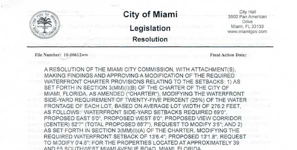
• Waiver of City Charter and Zoning Code to reduce waterfront “view corridor” and publicly accessible sideyard connectors from code required 69’ to 20’
• Waiver of City Charter and Zoning Code to reduce waterfront setback and public Riverwalk from 13 feet 6.4 inches to 13 feet 1.8 inches
• Waiver to reduce parking spaces by 30%
• Waiver to reduce street setback (along on-road Miami River Greenway) from 10’ required to zero (0’)
• Waiver to allow zero (0’) setback at the frontage above the 8th floor
• Waiver to allow increase in building length from 180’ to 215’
The existing on-road Miami River Greenway, constructed with federal grant funding on City owned South Miami Ave Road directly in front of the private development site, currently features a 13’ wide Greenway featuring 5 foot wide landscaping, benches, decorative trash cans, way-finding signage, decorative lighting, etc, plus an additional 8 foot wide unobstructed sidewalk. The current development plans propose to replace this existing on-road Miami River Greenway with 4 private parallel parking spaces on City owned land, which reduces the sidewalk width to 3’11”. The development team indicated they were unwilling to leave the existing 13’ wide section of the public on-road Greenway on City owned riverfront land, and maintained their request to replace it with 4 private parallel parking spots (reducing the sidewalk width to 3’11”). William Fitch, President of the Brickell on the River Homeowners Association, stated residents often use the existing on-road Miami River Greenway to walk to a nearby day care near Metro-Rail, therefore recommended not reducing its current width.
After reviewing the public Riverwalk plans, the development team offered to submit revised plans prior to the full NRC meeting with the following improvements:
• Correcting “13 foot wide” waterfront setback and Riverwalk to intended 13’and 1.8 inches (requiring reduction to requirements of City Charter and Zoning code)
• Widening the public Riverwalk’s unobstructed “circulation zone” from current 5’ width
• Removing the single proposed new vehicular parking spot close to Miami Ave Bridge
• Include code required public Riverwalk signage
• Widen the on-road Miami River Greenway (current 3’11”)
MRC Urban Infill Chairman Murley and Greenways Chairman Martin suggested the MRC recommend approval of development on this site with the following conditions:
1. Widen public Riverwalk to 13’ 6.4”, and widen its unobstructed circulation zone (to 7’ – 9’6”)
2. Widen 2 public side-yard connectors
3. Include public Riverwalk signage
4. Consistency with the City Charter and Miami Zoning Code (“Miami 21”)
5. Remove the single proposed new vehicular parking spot close to Miami Ave Bridge
6. Widen on-road Miami River Greenway, remove proposed creation of private parallel parking on Miami River Greenway located on City owned South Miami Ave Road
7. A $713,756 dollar federal grant was used by the City of Miami to construct a section of the on-road Miami River Greenway on City owned land, including the area in front of the subject private development site. If the private site’s development results in alterations, removal or replacement of these recently constructed improvements, the City should remain compliant with their Federal grant contract (i.e. assess additional impact fee from the developer to relocate the same linear feet of on-road Miami River Greenway to another needed location along the Miami River Greenway).”
This item will be placed on the MRC’s May 9 public meeting agenda, noon, 1407 NW 7 ST.
II) Discussion of Climate Change and Sea- Level Rise
As requested by the MRC when this item was recently presented to the full board, Tiffany Troxler, Director of the Florida International University Sea Level Solutions Center returned to the MRC subcommittees. The concept of creating a voluntary development score card / checklist was discussed to consider a development as “Certified Sea Level Safe”. The “Union of Concerned Scientists Fact Sheet Sea Level Rise and Tidal Flooding Along the Atlantic Coast- Encroaching Tides in Miami-Dade County, FL – Investigating in Preparedness to Manage the Impacts of Rising Seas” was distributed. The MRC subcommittee previously recommended as part of the City’s current process to consider amendments to the Comp Plan, the City should consider amendments regarding Climate Change and Sea Level Rise. Chairman Murley stated the Nature Conservancy. Miami-Dade County and the University of Miami are partnering to improve existing public greenspace along Wagner Creek with “green infrastructure”.
The meeting adjourned.
|
April 22, 2016 | THIS IS A PUBLIC DOCUMENT
The Miami River Commission’s (MRC) Urban Infill and Greenways Subcommittees conducted a joint public meeting on April 22, 2016, 2:00 PM, 1407 NW 7 Street. The attendance sign in sheet is enclosed. MRC Urban Infill Subcommittee Chairman Jim Murley and MRC Greenways Subcommittee Ernie Martin conducted the meeting.
|
MRC’s Urban Infill Subcommittee Minutes
I) Consideration of Revised Plans for “Seavault” Located at 1583 NW 24th Avenue
MRC Director Brett Bibeau distributed the following excerpt from the MRC’s most recent consideration of this site on March 2, 2015:
VI) Consideration of “SeaVault”, 1583 NW 24 Avenue (MRC previously approved “Miami Mega-Yacht Club”
Updated proposed plans, the MRC Urban Infill and Greenways February 11, 2015 public meeting minutes, and the MRC’s March 3, 2014 public meeting minutes were distributed one week prior to the meeting, and additional copies were distributed at the meeting, stating in part:
“MRC Director Bibeau referenced an email he received from Scott Bakos, Bermello Ajamil & Partners representing Tony Rodriguez and Homero Meruelo on the SeaVault project located at 1583 NW 24th Avenue (formerly approved by the MRC on 3/3/14 as “Miami Mega Yacht Club”) stating in part, ‘making a presentation to you / the board to present the progress of this project. By separate email, I will send you the latest drawings and renderings.
Overall, the SeaVault project (programmatically and the overall site plan layout) is the same as you last saw. We have a total of (14) fourteen private covered slips that range in length from 150 feet to 230 feet long. Each private slip / berth has a “Captain and Crew Quarters” which is a (3) three level ancillary support building directly adjacent (at the end) of each berth / slip. The project still has a small cold storage building, club-house, pool and tennis court for the crew. All of this remains the same from what Tony presented to you previously. What has changed is the look; the Architecture is modern. The main building that houses the (14) fourteen slips is broken into (3) three parts or sections, each section has a sweeping curve roof that will be a combination of solid and Kalwall to allow natural light into all slips so that work on the vessels while berthed can be done without the need for artificial light, which also provides for a dramatic night-time appearance. The Captain and Crew Quarters step back at each level and inherently scaled down the main building facing 15th street. This stepping provides a transition and favorable compatibility to the surrounding neighborhood.’
Director Bibeau added the applicant told him in consultation with the City of Miami there is a covenant / restriction that the referenced “Each private slip / berth has a “Captain and Crew Quarters” which is a (3) three level ancillary support building directly adjacent (at the end) of each berth / slip.” must be owned and occupied by the owners, and they will not be allowed to sell or rent the “Captain and Crew Quarters” to parties not directly connected to the respective mega yacht slip.
MRC Urban Infill Chairman Murley and MRC Greenways Chairman Martin suggested the full MRC continue to support the MRC’s following 3/2/14 resolution, “The Miami River Commission unanimously found the “Miami Mega-Yacht Club” proposal consistent with the adopted Miami River Corridor Urban Infill Plan, and therefore support it receiving all needed permits and approvals as required by various codes in order to come to fruition.”
Scott Bakos, Bermello Ajamil & Partners and Mr. Tony Rodriguez presented the subject updated and distributed plans. The MRC adopted a unanimous resolution reaffirming the MRC’s previously adopted March 2, 2014 resolution, “The Miami River Commission unanimously found the “Miami Mega-Yacht Club”, renamed “SeaVault” proposal consistent with the adopted Miami River Corridor Urban Infill Plan, and therefore support it receiving all needed permits and approvals as required by various codes in order to come to fruition.”
The site owner Homer Meruelo stated despite best efforts for pre-sales, apparently Mega Yacht owners and captains prefer to be docked closer to the mouth of the Miami River, rather than west of 22 Ave which takes time to be towed in the Miami River’s idle no wake speed zone etc. Therefore Mr. Meruelo and his architect Leo Bellon distributed and presented the site’s revised plans featuring 45 boat slips and 45 commercial units for residential, storage or office uses. The boat slip sizes are 15 slips at 100’ x 20’, 15 slips at 75’ x 18’, 15 slips at 50’ x 15’ for a total of 45 boat slips which is consistent with the site’s current Marine Operating Permit for 45 total slips. . The commercial units will have unity of title with the boat slips, therefore each boat slip must be sold with one commercial unit, and commercial units will not be sold with a boat slip. The 45 self- standing commercial units are 3 stories each, featuring 3,500 – 4,000 square feet each, and a portion of the existing water slips would have to be filled with new land to create sufficient upland to construct the proposed 45 commercial units. Mr. Meruelo stated he would provide a draft Working River Covenant, as required by the Comp Plan. Mr. Bellon stated he would provide elevations of the proposed 45 commercial units. The site is currently zoned D3 under the Port Miami River sub-element of the Comp Plan, and Mr. Meruelo stated he hopes the City of Miami would grant the request via amending their previously approved administrative waiver for the previously proposed 14 commercial units.
MRC Director Bibeau distributed copies of the site’s current Port Miami River sub-element of the Comp Plan, and a page of the Miami 21 Zoning code indicating the site’s current D3 zoning does not allow any residential units, while the D1 zoning (still under Port Miami River sub-element of the Comp Plan) would allow 36 units per acre.
MRC Urban Infill Subcommittee Chairman Murley made the following non-binding recommendation to the full MRC:
1) The current proposal is not consistent with the site’s existing D3 zoning (because 45 units proposed in D3 which does not allow units) and is not consistent with the Miami River Corridor Urban Infill Plan
2) Procedurally the proposed plans should be considered as a zoning amendment application (yet to be filed) from D3, which does not allow units, to D1 which allows 36 units per acre
3) When any Miami River development site reconstructs the adjacent public right of way (street and sidewalk) it should be consistent with the City of Miami’s adopted on-road Miami River Greenway design standards and guidelines
4) If this site is redeveloped, allow the public Riverwalk to the east at River Run South to exit and enter via a new public sideyard Miami River Greenway connector on the subject site (1583 NW 24 Ave) connecting the sidewalk on the street to the public Riverwalk at River Run South
MRC Urban Infill subcommittee Chairman Murley stated the item maybe considered by the full MRC on June 6, noon, 1407 NW 7 ST, or the developer team may ask for the item to be deferred and considered at a later MRC meeting.
II) New Business
MRC Director Bibeau stated after scheduling a site visit at the Sushi Samba construction site on North River Drive between Flagler and 1 ST Bridges, the architects provided a set of plans which were significantly different from the plans they previously presented to and were supported by the MRC. For example the public riverwalk’s unobstructed width had been reduced to only 4’ wide. Therefore the architect agreed to improve the current plans and submit them to the MRC. Director Bibeau stated he had followed up and asked the architect for the updated and current plans, but the developer team is yet to provide them. MRC Director Bibeau stated the City of Miami and the Waterfront Advisory Board were notified of these surprising and concerning as built conditions.
The meeting adjourned.
|
May 19, 2016 | THIS IS A PUBLIC DOCUMENT
The Miami River Commission’s (MRC) Urban Infill Subcommittee conducted a public meeting on May 19, 2016, 3:00 PM, 1407 NW 7 Street. The attendance sign in sheet is enclosed. MRC Urban Infill Subcommittee Chairman Jim Murley conducted the meeting.
|
Miami River Commission’s
Urban Infill & Greenways Subcommittee’s Combined Minutes
I) Review of 40 SW North River Drive, “Sushi Samba / Duck and Waffle House” As Built Conditions and MRC Approved Plans
Brett Bibeau, Managing Director of the Miami River Commission, provided the following documents:
• MRC’s 11/3/14 public meeting minutes featuring plans for this site state in part, “features the public Riverwalk consistent with Miami 21 Section 3.11, Appendix B, and the City Charter”
• Development Plans presented and approved at the MRC’s 11/3/14 public meeting featuring a 14-foot wide public Riverwalk, including an 8’4” wide unobstructed circulation zone, 1-foot wide transition zone, 1’8” wide passive zone, and a 3’ wide safety zone, continuous across the entire site
• Revised Development Plans provided by developer team at a site visit on March 15, depicting a public Riverwalk inconsistent with Miami 21 Section 3.11, Appendix B and the City Charter, as the width was reduced from 14’ required to 12’ wide total, while reducing the unobstructed circulation zone from 8’4” wide to 4’6” (ADA requires 5’ minimum) - 5’10”. In addition the revised narrower public Riverwalk, which is no longer consistent with Miami 21 Section 3.11, Appendix B and the City Charter, is now no longer continuous across the entire site, and the public side-yard connectors (from sidewalk to public Riverwalk on both sides) were reduced in width as well.
• Picture of on-site conditions taken during the March 15 site visit, depicting the as built conditions which appear to be inconsistent with Miami 21 Section 3.11, Appendix B and the City Charter, and narrower than previously presented to the MRC
• 5/27/15 email from project architect Arturo Griego to Bibeau stating, “we have made it pretty clear that the walkway is unobstructed”
• 3/9/16 email from project architect Arturo Griego stating in part, “it should not be different than you last saw”
• 3/31/16 email from Bibeau to Griego, “PLS reply the updated plans”
• 3/31/16 email reply from Griego to Bibeau, “working on it now”
• 4/18/16 email from Bibeau to Collin Worth, City of Miami Bike / Ped Coordinator noting the issue at hand
• 6/10/16 email from Bibeau to Griego stating:
“Per our conversation 6/22, 3 PM, 1407 NW 7 ST, smaller multi-purpose room
PLS bring 10 copies of original plans presented to MRC and 10 copies of current plans
PLS email new plans and old plans by 6/21, THX and have a nice day
Sincerely,
Brett”
Mr. Bibeau stated during the site visit the construction foreman indicated part of the problems with the narrowed Riverwalk width were created by a late change in the site’s elevations, which upset the architects whom were unaware of this unfortunate change which negatively impacted the planned width of the public Riverwalk.
Mr. Bibeau stated over the past few months he reported this issue on the record at the City of Miami’s Waterfront Advisory Board twice, notified 2 members of the City of Miami’s Planning Department, and a member of the Building Department.
Mr. Bibeau stated the development team didn’t accept the invitation to participate in this public meeting, and they didn’t email the MRC’s repeatedly requested updated development plans and City Building Permit. The City of Miami recently informed Director Bibeau that this site is being constructed under a “phased permit”, where the developer assumed liability for constructing ahead of final building permits, and is therefore responsible to correct anything constructed which upon inspection by City is deemed inconsistent with Miami 21 Zoning Code or the City Charter.
MRC Urban Infill Subcommittee Chairman Murley and Greenways Subcommittee Chairman Martin suggested the MRC reaffirm the 11/3/14 recommendation for approval of the project which featured a public Riverwalk consistent with Miami 21 Section 3.11, Appendix B, and the City Charter. Chairmen Murley and Martin suggested MRC Chairman Aguirre and Director Bibeau continue communications with the City of Miami and Development team leading up to this time sensitive item being considered by the full MRC on July 11, noon, 1407 NW 7 ST.
II) Consideration of Proposed Miami Circle Phase II Improvements
Kerri Post, Deputy Secretary of State, and Dr. Timothy Parsons, Department of State (DOS), presented a “Miami Circle Update” Powerpoint. Ms. Post thanked MRC Director Bibeau for his positive assistance in addressing numerous issues at Miami Circle Park such as removal of homeless camps, significant illegal parking, park maintenance and landscaping, etc. Mr. Bibeau thanked Ms. Post and Dr. Parsons for their support in moving the Miami Circle Park forward in a positive direction.
Ms. Post presented the site’s “Phase I” improvements including replanting the existing planter beds along the public Riverwalk, installing bolder benches, bolders to block illegal parking, and dog waste stations. Phase I is under contract and estimated for completion before the end of the State’s fiscal year on June 30, 2016.
Ms. Post presented the 1st draft Phase II improvements to Miami Circle Park which includes a life size 3D model / replica of the actual Miami Circle, additional historic signage, installing three additional seating areas, and filling the majority of the currently open greenspace with 3 foot tall “ground cover” native plants. Ms. Post stated the current 1st draft Phase II plan has not been finalized. The Powerpoint included a couple “Current Conditions” pictures taken in March or April showing dirt on much of the planned grass area. Director Bibeau provided more recent “Current Conditions” pictures of the site taken this month which show the grass areas have recovered and the formerly barren areas of dirt are now green grass (irrigation system was previously turned off, and was turned back on a few months ago). Mr. Bibeau asked Ms Post to please replace the “Current Conditions” pictures in the presentation with the provided more current pictures, prior to the July 11 presentation to the MRC, noon, 1407 NW 7 ST.
Ms. Post noted the site has issues with violations of laws regarding dogs, for example some owners are allowing there dogs off leashes and not throwing away dog waste. Director Bibeau thanked City of Miami Police SGT Valdes and his officers whom recently completed training on the current dog laws and will start enforcing them at Miami Circle Park. Director Bibeau noted the City of Miami’s standard Park Laws do not allow dogs, and several years ago DOS and History Miami posted signs indicating no dogs allowed in Miami Circle Park. Since then DOS decided to again allow dogs in Miami Circle Park (featuring a dog water fountain), which is a designated National Historic Landmark.
Greg Bush, Urban Environment League (UEL), served on the DOS Miami Circle Planning Committee and played a significant role in preserving the site. Mr. Bush sent an email stating, “I think more attention should be paid to showcasing the real Miami Circle site – finding the technology to display it while keeping it safe from the elements…I also dislike covering over much of the grass with low shrubs. The public needs more positive waterfront space for picnics and such activities.”
Mr. Parsons stated DOS has analyzed ways to display the real Miami Circle and provide needed protection from the elements, and determined it is not possible to display the actual Miami Circle while providing sufficient protection from the elements. Therefore DOS is proposing the life size 3D replica / model on the exact location of the Miami Circle, which will remain covered by dirt for protection.
Dr. Martin noted the small site’s current design was created after over a decade of public meetings, Planning Committees, charrettes etc. After Miami Circle Park was completed and opened to the public, it was awarded a National Historic Landmark designation. Based on extensive public input, the site includes 3 small open greenspace / grass areas which allow for multiple public recreational uses. Miami has the least square footage of open public greenspace of any large City in the U.S., and the immediate area is densely populated with an additional adjacent over 1,600 approved residential units starting construction soon.
MRC Greenways Subcommittee Chairman Martin and Urban Infill Subcommittee Chairman Murley recommended approval of the Miami Circle Park Phase I and Phase II improvements with one condition, preserving the originally planned and existing open green space / grass areas.
The meeting adjourned
|
June 22, 2016 | THIS IS A PUBLIC DOCUMENT
The Miami River Commission’s (MRC) Urban Infill and Greenways Subcommittees conducted a joint public meeting on June 22, 2016, 3:00 PM, 1407 NW 7 Street. The attendance sign in sheet is enclosed. MRC Urban Infill Subcommittee Chairman Jim Murley and MRC Greenways Subcommittee Ernie Martin conducted the meeting.
|
|
c/o Robert King High • 1407 NW 7 Street, Suite D, Miami, FL 33125 • 305-644-0544 • Fax: 305-642-1136 • Contact us email |
|
|
|